File:2036 Darmeni general election map.png
Jump to navigation
Jump to search
No higher resolution available.
2036_Darmeni_general_election_map.png (393 × 450 pixels, file size: 46 KB, MIME type: image/png)
Summary
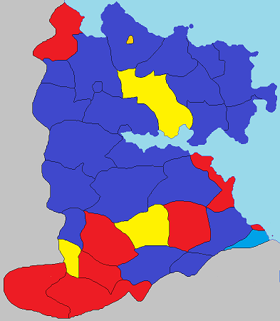
A map showing the parties winning pluralities of votes in each county and municipality.
File history
Click on a date/time to view the file as it appeared at that time.
| Date/Time | Thumbnail | Dimensions | User | Comment | |
|---|---|---|---|---|---|
| current | 09:30, 1 November 2023 | | 393 × 450 (46 KB) | Admin (talk | contribs) | == Summary == Importing from miraheze image dump |
You cannot overwrite this file.
File usage
The following page uses this file: